Mystery GPS jammer in Iran becomes test for NASA satellites’ capabilities
NASA science satellites show dual use in locating sources of GPS interference.
Mystery GPS jammer in Iran becomes test for NASA satellites’ capabilities - Ars Technica
Skip to content
Text settings
Story text
Size
Small Standard Large
Width *
Standard Wide
Links
Standard Orange
* Subscribers only Learn more
Minimize to nav
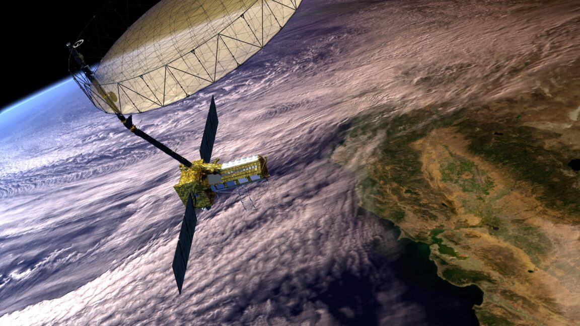
NASA satellites designed to observe cyclone wind speeds and collapsing ice sheets have also proven capable of identifying the approximate locations of GPS jammers. That could help monitor high-risk areas for aircraft and ships navigating the growing prevalence of GPS interference worldwide. Two different NASA satellite systems showed how they could locate a known but mysterious GPS jammer within several kilometers of its position in Iran, according to an experiment by Sean Gorman, CEO and cofounder of the location-based technology company Zephr.xyz that was detailed in the magazine GPS World. Such jammers use strong signals to overpower the weaker radio signals coming from US-operated GPS satellites and other global navigation satellite systems. Such NASA satellites cannot perform “near-real time monitoring” or pinpoint the exact location of GPS jammers, said Clara Chew, principal scientist and lead of the GNSS systems and data team at the California-based satellite manufacturer Muon Space, who was not involved in the study. But Chew told Ars that identifying the approximate locations of GPS jammers “could potentially be helpful for flight planning” or for “indicating high risk areas for maritime shipping.” One of the NASA satellite systems, the Cyclone Global Navigation Satellite System (CYGNSS), has eight microsatellites that detect GPS signals reflected from ocean surfaces to measure wind speeds within the eyewalls of hurricanes, tropical cyclones, and typhoons. When an Earth-based jammer turns on, the effect creates a huge footprint in the reflected GPS signals that can show up hundreds of kilometers from the jammer’s location. The other satellite system, NASA-ISRO Synthetic Aperture Radar (NISAR), typically uses radar imaging to continually map and track changes across the Earth’s surface, including earthquakes, tsunamis, volcanoes, and ice sheet collapses. GPS jammer emissions create streaks in the NISAR radar imagery that run perpendicular to flight direction—meaning that “each streak encodes the jammer’s direction relative to the satellite’s ground track,” Gorman wrote in his GPS World article. “CYGNSS sees the jammer’s effect on reflected GPS signals, offering an indirect measurement spread across hundreds of specular reflection points,” Gorman wrote. “NISAR sees the jammer’s emissions directly in its own receiver, which is a more precise measurement, but only along the satellite’s narrow ground track.”
Comparing satellite systems To validate the NASA satellite systems’ performances using a known jammer location, Gorman and colleagues first used “independent signals intelligence” to identify and locate a GPS jammer operating near the city of Shiraz in Iran. This mystery jammer has been active since the start of 2026 and has continued operating at even higher power since the war began with the US and Israel attacking Iran on February 28, 2026. The researchers then ran a controlled experiment that looked at the NASA satellite data during two “jammer on” dates from January 8 and January 20, 2026, along with two “jammer off” dates from December 15 and December 27, 2025. They applied several detection and signal analysis techniques to both the CYGNSS and NISAR data in order to come up with the best approximations for the GPS jammer’s location. The experiment showed that CYGNSS located the jammer within 4.33 kilometers of the ground truth, with a circular error probable of 3.48 kilometers. The latter means 50 percent of the estimates from repeated analyses on many similar jammers would fall within 3.48 kilometers. By comparison, NISAR located the jammer to within 6.26 kilometers of the ground truth while demonstrating a circular error probable of 6.88 kilometers. So CYGNSS came out on top.
Still image showing NISAR’s orbit and ground swath (in orange), alongside the rest of NASA’s Earth-observing satellite fleet, such as the CYGNSS micro-satellites (in cyan). Credit: Kel Elkins | NASA Still image showing NISAR’s orbit and ground swath (in orange), alongside the rest of NASA’s Earth-observing satellite fleet, such as the CYGNSS micro-satellites (in cyan).
Credit:
Kel Elkins | NASA
Gorman and colleagues also attempted to combine “CYGNSS’s wide-area sensitivity with NISAR’s geometric precision” in a fused approach. That fused result located the jammer to within 4.69 kilometers with a circular error probable of 7.85 kilometers, which fell short of the standalone CYGNSS result but still showed how “two independent physics arriving at similar locations builds confidence that neither sensor is producing an artifact,” Gorman wrote. It is unusual to see worse performance with the fused approach compared to using CYGNSS alone, said Todd Humphreys, director of the Wireless Networking and Communications Group and the Radionavigation Laboratory at The University of Texas at Austin, in correspondence with Ars. But he said that can happen when calculating the circular error probable based on real-world error data—and he praised the overall work for achieving “such accurate results” using publicly available satellite data.
The demonstration built on earlier research by Chew and colleagues that used CYGNSS data to map regions rife with GPS interference and identify possible jamming sources. “My work didn’t try to geolocate jammers like Gorman’s does—I was simply gridding the noise variable to 9 km and associating ‘hot spots’ with known conflict areas around the world,” Chew explained. Keeping tabs on GPS jamming Such NASA satellites cannot provide “near-realtime monitoring of GPS jammers” because it can take up to several days for collected data to become publicly available, Chew said. She would be “surprised” if this could deliver very precise geolocation of jammers, but still expressed interest in seeing such methods repeated on other known jammers to measure how consistently they can get within five kilometers of actual locations. Harnessing this capability from NASA satellite data could allow researchers to better filter out interference from GPS jammers that may impact NASA science missions, Chew said. But she also highlighted the potential usefulness for supporting aviation and maritime navigation warnings, along with aiding open source intelligence investigators who track GPS interference across the world. Navigation interference resulting from GPS jamming has spread well beyond major conflict zones in Ukraine and the Middle East to impact shipping in the Baltic Sea and Mediterranean, along with maritime traffic in the South China Sea. About 900 flights experience GPS disruptions daily, with degraded GPS service affecting a dozen or so transatlantic flights. Given this unwelcome trend, there is growing interest in a wide variety of GPS alternatives. When the US military launched Operation Epic Fury against Iran, more than 1,100 ships experienced GPS interference across the Persian Gulf between February 28 and March 1, 2026. Much of the contested Strait of Hormuz is still experiencing GPS jamming and spoofing, with the latter involving false signals that trick GPS receivers into reporting inaccurate positions. Meanwhile, NASA’s CYGNSS satellite data shows the mystery jammer is operating at “dramatically higher power” with a fivefold increase in signal intensity since the start of the Middle East conflict. Possible explanations include the jammer operator increasing power output to ward off potential US or Israeli military strikes using GPS-guided weapons, more jammers becoming active in the area, or a shift from intermittent to continuous operations, Gorman said. In any case, the NASA satellites’ passive, persistent monitoring capabilities may serve well in letting us know what happens next.
Jeremy Hsu
Tech Reporter
Jeremy Hsu Tech Reporter
Jeremy Hsu is a reporter exploring a wide range of topics across deep tech and AI. He has previously written for New Scientist, Scientific American, IEEE Spectrum, Wired, Undark
📰Originally published at arstechnica.com
Staff Writer
Related Articles
Hands-on: GoPros new Mission 1 Pro bridges the gap between action and cinema cameras
May 27, 2026·1 min read
Websites have a new way to spy on visitors: analyzing their SSD activity
May 27, 2026·1 min read
Sony RGB TVs are finally here and skipping the preorder window. What to know about Bravia 7 II and 9 II.
May 27, 2026·1 min read